Genoa Maps and Orientation
(Genoa / Genova, Liguria, Italy)
Greater Genoa extends along north-western Italy's shoreline for some 30 km / 19 miles and enjoys impressive scenery. The city itself is sited within the Liguria region of north-western Italy and is served by no less than 15 train stations. Genoa's two principal stations (Brignole and Principe) are to be found alongside the very heart of the city.
The majority of shops lie along the Via XX Septembre boulevard, which is within easy walking distance of the Stazione Brignole and has become a hub of activity, particularly around the Piazza de Ferrari. Directly west and close to Genoa's port, the historic Genoese district is brimming with charm and interest.
Maps and Orientation of the City
Those looking for maps of Genoa will find a number of reliable bookshops. These include the Libreria Porto Antico on the Palazzina Milo and also the Touring Club Italiano Genoa on the Via XX Septembre.
- Brughe - 10 km / 6 miles (12 minutes, north)
- Busalla - 29 km / 18 miles (35 minutes, north)
- Cascinetta - 29 km / 18 miles (35 minutes, north)
- Maxena - 19 km / 12 miles (20 minutes, east)
- Nervi - 11 km / 7 miles (15 minutes, south-east)
- Novi Ligure - 61 km / 38 miles (55 minutes, north)
- Parma - 217 km / 135 miles (two hours and 30 minutes, north-east)
- Pontedecimo - 18 km / 11 miles (20 minutes, north-west)
- Quinto Al Mare - 10 km / 6 miles (12 minutes, south)
- Rapallo - 30 km / 19 miles (35 minutes, east)
- San Bartolomeo - 32 km / 20 miles (35 minutes, north)
- San Siro - 30 km / 19 miles (35 minutes, north-east)
- Sant Olcese - 24 km / 15 miles (30 minutes, north)
- Savona - 48 km / 30 miles (45 minutes, west)
- Serra Riccò - 19 km / 12 miles (20 minutes, north-west)
Map of Italy

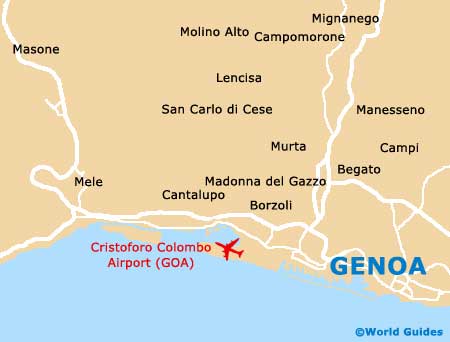
Map of Genoa